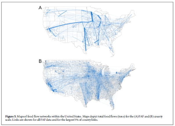
Dr. Megan Konar has developed an algorithm for mapping food flows between counties in the United States based on FAF data. This algorithm downscales FAF data to the county level to provide a spatially-detailed map of food flows. By building on previous models with known network properties of food flows and the principle of mass balance, this algorithm improves spatial detail and accuracy of food flow mapping. Mapping flows of commodity with higher resolution enables detailed lifecycle and footprint assessments.This technology uses US Census Bureau data to provide realistic and high-resolution estimations of food flows between counties, providing information about distribution of food through complex supply chains, which underpins food security and has implications for the environment.